
GEOCITIZEN – CHANNELS
GeoCitizen – The digital georeferenced survey platform
GeoCitizen – The digital georeferenced survey platform
The GeoCitizen enables digital surveys with the added value of geographic analysis. Municipalities, companies and organizations can use this web-based application to involve their citizens, customers and employees in decision-making processes and in the development and implementation of projects. The planning and coordination is made easier, more efficient and cheaper.
Use platforms
The channels on www.buergercockpit.org are the channels of the individual communities or organizations that use the GeoCitizen. In the upper area you will find the different views of how you can display the channels.

- SUBSCRIBED: Platforms to which you, as a registered user, have subscribed.
- NEARBY: Channels in your area. Displayed by distance. Prerequisite you have given the GeoCitizen the opportunity to determine your approximate location using your IP.
- DISCOVER: A map with all channels. If you zoom in with your mouse or fingers you can see more. This was done so as not to overload the view with points.
- PROJECTS: Here you can search for projects, surveys or channels.
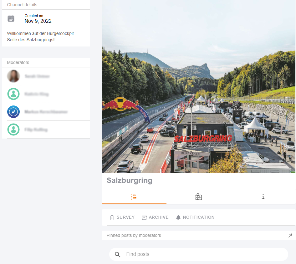
You can find details about the municipality or the project on the individual channels.
- Left column: Under “Channel details” you find the creation date and a welcome text. Below you will find the moderation team.
- Middle column: The channel picture with the option to a) log in or create an account and then b) subscribe to the channel to stay up to date and not miss anything. Subscribing to a channel is only available to registered people. Below you will find the latest events as you are used to from many other social media. It is also possible to pin messages so that they are always displayed first. Here you will also find the latest surveys, participations, suggestions and, in principle, the communication of the channel.
 |
|
 |
The advantages of being a registered user of www.buergercockpit.org:
All these advantages are of course free of charge and your personal information is included |